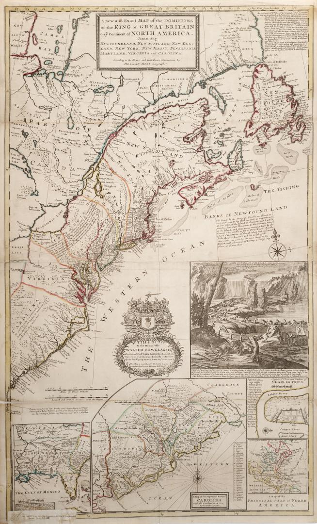

A new and exact map of the Dominions of the King of Great Britain on ye Continent of North America, Containing Newfoundland, New Scotland, New England(...)
Date1715
Names
Moll, Herman, -1732
(author)
Tho. Bowles, John Bowles and J. King
(publisher)
FormatMap
NotesA new and exact map of the Dominions of the King of Great Britain on ye Continent of North America, Containing Newfoundland, New Scotland, New England, New York, New Jersey, Pensilvania, Maryland, Virginia and Carolina
Subject
GeographyProvince stateNew Brunswick||Nova Scotia||Prince Edward Island||Newfoundland||Maryland||New Jersey||New York||North Carolina||Pennsylvania||South Carolina||Virginia
Medium
Dimensions1"=60 miles : 104.5 x 64 cm
Language
ProvenanceGift of James Bain family, 2008
CollectionBaldwin Collection of Canadiana
Usage Rights
Public Domain
(Learn More)
Object Number912-7M58


Robert de Vaugondy, Gilles, 1688-1766
1755