
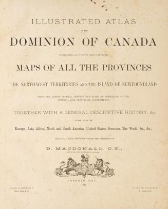
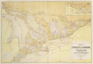
Illustrated atlas of the Dominion of Canada: containing authentic and complete maps of all the provinces, the North-West Territories and the island of Newfoundland from the latest official surveys and plans, by permission of the general and provincial governments : together with a general descriptive history, &c. : also, maps of Europe, Asia, Africa, North and South America, United States, Oceania, the world, etc., etc. and local maps
Date1881
Names
H. Belden & Co.
(cartographer)
H. Belden & Co., cartographer, issuing body
(publisher)
Rolph, Smith & Co.
(engraver)
Rolph, Smith & Co.
(lithographer)
MacDonald, D. (Cartographer)
(contributor)
FormatBook
NotesScales differ
Includes index
Includes index
The illustrated atlas of the Dominion of Canada was issued only to subscribers including the relevent supplement for their own county which includes historical and biographical information and illustrations, including a list of subscribers and maps of the various townships divided into lots ; these maps only show the names of subscribers
Subject
DimensionsCover size: 45 cm x 37 cm (17 11/16 in. x 14 9/16 in.)
Language
CollectionBaldwin Collection of Canadiana
Usage Rights
Public Domain
(Learn More)
Object Number37131099670762D
Catalogue Record for Print Book
https://www.torontopubliclibrary.ca/detail.jsp?Ntt=1568013


Bowen, Emmanuel, 1693?-1767
1760 circa


Bolton, Lewis O.L.S.
1888