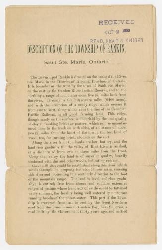
Sault Ste. Marie, from the south side, Lake Huron (Ontario)
Date1876
Names
White, George Harlow, 1817-1887
(author)
FormatPicture
NotesSault Ste. Marie, from the South Side, Lake Huron (Ontario), boundary line of U. S. & Canada. After a wood engraving ''Sault Ste. Marie (from the South Side.)'' in George M. Grant, Ocean to Ocean, 1873, Plate 2, facing p. 19.
Subject
Medium
Dimensions78 x 120 mm
Language
CollectionBaldwin Collection of Canadiana
Usage Rights
Public Domain
(Learn More)
Object NumberPICTURES-R-864

Sault News Service ( Sault Ste. Marie, Ontario)
Approximatley 1951


Toronto Star (Firm)
3 September 1988