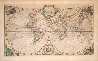
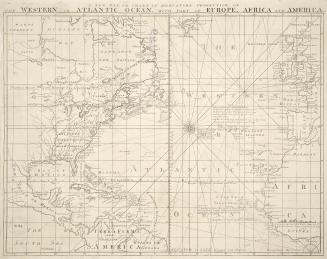
A new & accurate chart of the Western or Atlantic Ocean drawn from surveys and most approved maps & charts
Date1744
Names
Bowen, Emmanuel, 1693?-1767
(cartographer)
FormatMap
NotesAt lower right 'Vol II page 3 From Harris, John. 'Navigantium atque Itinerantium', London, 1744
Subject
Dimensions 41 x 48 cm
Language
CollectionBaldwin Collection of Canadiana
Usage Rights
Public Domain
(Learn More)
Object Number912-4-B596-SMALL
Bowen, Emmanuel, 1693?-1767
Approximately 1740
Hodder, Edward Mulberry, 1810-1878
1857
Austin, Walter F. (Walter Forward), 1872-
1858

Ontario. Department of Education
1856