

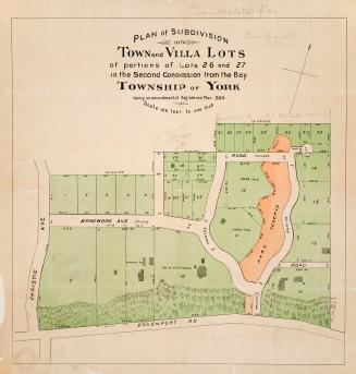
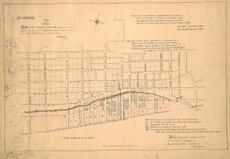
Plan of parts of lots 18 and 19 York
Date1881
Names
Browne, Henry John, 1840-1920
(cartographer)
Browne, W. A.
(cartographer)
FormatMap
NotesPlan shows a portion of Rosedale, east of May St. to the Don River. Includes elevations. Shows the properties of E.J. Jarvis and E.B. Osler.
Subject
Dimensions41 cm x 47.5 cm (16 1/8 in. x 18 11/16 in.)
Scale1 inch = 200 feet
Language
CollectionBaldwin Collection of Canadiana
Usage Rights
Public Domain
(Learn More)
Object NumberMsX.9

Denison, George T. (George Taylor), 1839-1925
1855


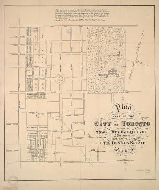
Alexander & Cable Lithographing Co. Ltd
1884

Alexander & Cable Lithographing Co. Ltd
1890
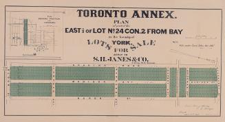
Dennis, John Stoughton, 1820-1885
1854
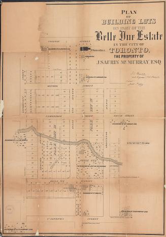
Browne, John Ownsworth, 1808-1881
1 January 1869
Rordans and Carter, Law Stationers & Lithographers
1860

Denison, George T. (George Taylor), 1839-1925
1853
![With the exception of the lots on the Bay shore and those on Dundas or Lot Street coming under the head of sections A and C this plan is merely a proposed sketch of an intended addition to the town of York, His Excellency not having yet decided upon this internal arrangement [1833]](/internal/media/dispatcher/2109749/thumbnail)