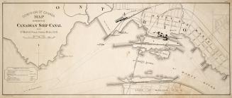
Map of Welland Canal
DateApproximately 1835
Names
Tazewell,Samuel Oliver
(lithographer)
FormatMap
NotesIncludes table of distances
Dimensions45.5 cm x 60.5 cm (17 15/16 in. x 23 13/16 in.)
Language
CollectionBaldwin Collection of Canadiana
Usage Rights
Public Domain
(Learn More)
Object Number386-A73-SMALL