Skip to main content
Advanced Search Objects: results
Close
Refine Results
Show Only Public Domain
Format
Map
(923)
Book
(60)
Ephemera
(13)
Picture
(5)
Manuscript
(1)
Date
to
Names
Unknown
(70)
Burland Lithographic Co.
(37)
Goad, Charles E.
(37)
Chas. E. Goad, Ltd.
(35)
Ontario. Department of Crown Lands
(31)
Copp Clark Company
(29)
Jefferys, Thomas, -1771
(24)
Canada. Department of the Interior
(20)
Robertson, J. Ross (John Ross), 1841-1918
(20)
Pardee, Timothy Blair, 1830-1889
(18)
Load all
Subject
Load all
Collection
Baldwin Collection of Canadiana
(984)
Humanities and Social Sciences department
(8)
Osborne Collection of Early Children's Books
(3)
Toronto Star Photograph Archive
(2)
Archives of Ontario
(1)
Arthur Conan Doyle Collection
(1)
Local History Collection, Leaside branch
(1)
Special Collections in the Arts
(1)
Toronto Public Library Archives
(1)
Language
Building, monument or park
Toronto Harbour
(16)
Fort York
(8)
Canadian National Exhibition (CNE)
(1)
Fort Frontenac
(1)
Fort George
(1)
Fort Ticonderoga (N.Y.)
(1)
Louisbourg (N.S.)
(1)
Moulthorp Lumber Company
(1)
Osgoode Hall (Toronto, Ontario)
(1)
Provincial Lunatic Asylum
(1)
Load all
City, town or township
Toronto
(211)
Montréal
(17)
Québec
(16)
Ottawa
(6)
Belleville
(5)
Kawartha Lakes
(4)
King (Ont. : Township)
(4)
Vaughan
(4)
Ameliasburgh (Ont.: Township)
(3)
Hamilton
(3)
Load all
Neighbourhood
Harbour
(38)
Railway Lands
(24)
Garrison
(23)
King-Spadina
(20)
St. Lawrence
(20)
Exhibition
(18)
Financial District
(18)
Toronto Islands
(17)
Port Lands
(14)
Downtown
(11)
Load all
North-south street
Yonge Street
(11)
Bathurst Street
(7)
Dovercourt Road
(5)
Dufferin Street
(5)
Sherbourne Street
(4)
Bay Street
(3)
Christie Street
(3)
Leslie Street
(3)
Lippincott Street
(3)
Peter Street
(3)
Load all
East-west street
Bloor Street West
(18)
College Street
(7)
Davenport Road
(7)
Dundas Street West
(5)
Front Street West
(5)
Queen Street West
(5)
King Street West
(4)
Bloor Street East
(3)
Dupont Street
(3)
Front Street East
(3)
Load all
Sort:
Relevance
Date (Older First)
Date (Newer First)
Title (A–Z)
Title (Z–A)
Last Updated (Ascending)
Last Updated (Descending)
List
Images
Table
Previous
/ 51
Next
Advanced Search
Filters
Title
Names
Subject
Call Number / Accession Number
Date Range
to
Collection
All
Archives of Ontario
Arthur Conan Doyle Collection
Arts department
Baldwin Collection of Canadiana
Business, Science, and Technology department
Chinese Canadian Archive
City of Toronto Archives
Humanities and Social Sciences department
IBBY Collection for Young People with Disabilities
Languages and Literature department
Local History Collection, Annette branch
Local History Collection, Beaches branch
Local History Collection, Bloor/Gladstone branch
Local History Collection, Dufferin/St. Clair branch
Local History Collection, Gerrard/Ashdale branch
Local History Collection, Leaside branch
Local History Collection, North York Central Library branch
Local History Collection, Northern District branch
Local History Collection, Palmerston branch
Local History Collection, Parkdale branch
Local History Collection, Riverdale branch
Local History Collection, Sanderson branch
Local History Collection, Weston branch
Local History Collection, Wychwood branch
Merril Collection of Science Fiction, Speculation and Fantasy
Ontario History Quest
Osborne Collection of Early Children's Books
Special Collections in the Arts
Toronto Public Library Archives
Toronto Reference Library
Toronto Star Photograph Archive
Formats
All
Artifact (an object in our collections)
Book
Ephemera
Manuscript
Map
Photo Album
Picture
Language
All
Clear
1,002 for
Subject
:
http://nodes.emuseum.com/6QKN203O/apis/emuseum/network/v1/vocabularies/termMaster6716767
A voyage of discovery to the North Pacific Ocean, and round the world, in which the coast of North-west America has been carefully examined and accura(...)
1798
A voyage of discovery to the North Pacific Ocean, and round the world, in which the coast of North-west America has been carefully examined and accura(...)
1798
Plan of 206 acres in the Township of Newark otherwise called Niagara including 4 acres in the town of Niagara in Upper Canada, the property of the Hon. D W Smith Esqre. Surveyr. Genl.
1802
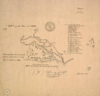
(1823) Plan of the fort at York, no. 24
Approximately 1908
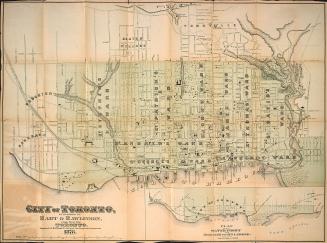
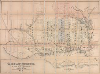
Hart & Rawlinson's Map of the City of Toronto, with Suburbs of Yorkville, Parkdale, Seaton Village, Brockton, and Ben-Lamond
1878
City of Toronto
1878
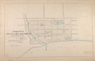
(1837) Toronto military reserve as laid out by Captn Bonnycastle Royal Engineers and resurveyed by William Hawkins Dy. Surveyor
Approximately 1908
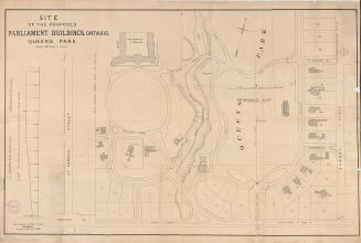
Site of the proposed parliament buildings, Ontario. Queen's Park
27 April 1880
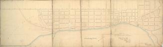
Toronto
1837
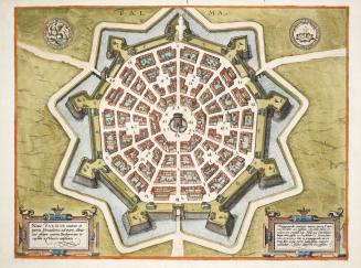
Palma
Approximately 1600
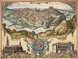
Toletum
1566
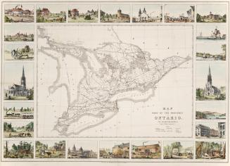
Map of the part of the province of Ontario for emigration purposes
1877 circa
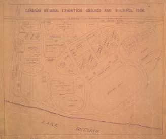
Canadian National Exhibition grounds and buildings, 1906
1906
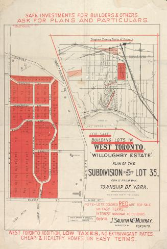
"Willoughby estate"; plan of the subdivision of part of lot 35, con. II from bay, township of York
1880
Runnymede Estate; a subdivision of the westerly parts of lots 39 and 40, con. 2 from the bay, township of York
1884
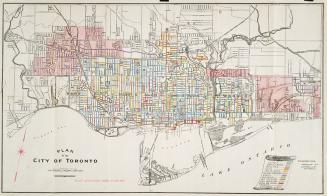
Plan of the City of Toronto
1909
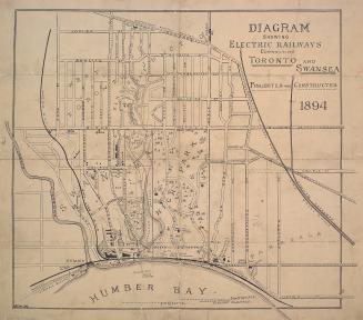
Diagram showing electric railways connecting Toronto and Swansea projected and constructed
1894
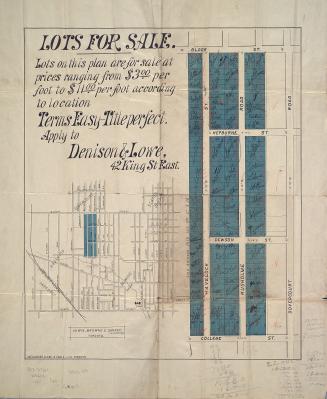
Plan of lots for sale in Dovercourt
1883
Vest pocket map and shipping instructions presented by McHugh Christensen Co. grain commission Winnipeg to shippers of grain in Manitoba and N.W.T.
1903
York Township, Ontario
1873
Previous
/ 51
Next
RDF
XML
JSON