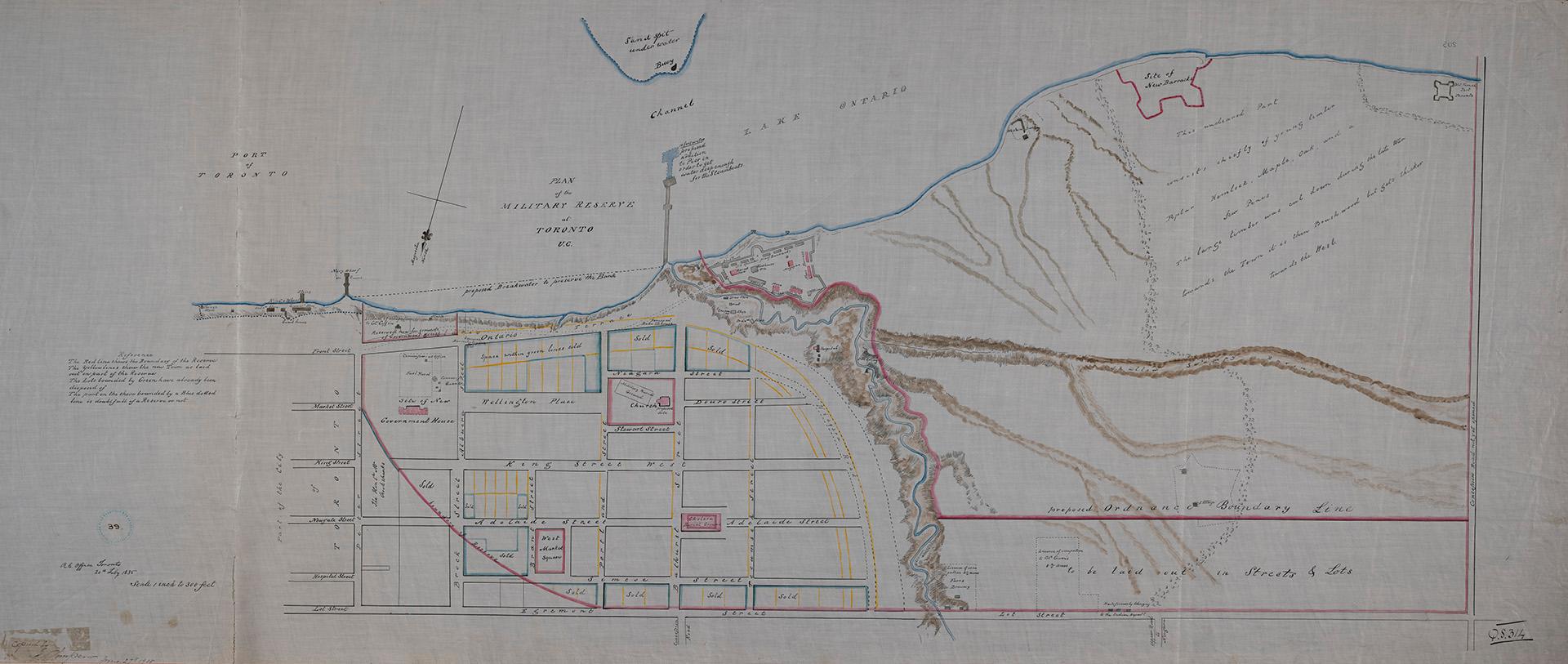

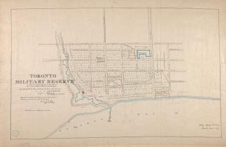
(1835) Plan of the military reserve at Toronto, U.C.
Date27 June 1908
Names
Royal Engineer Office (Toronto, Ont.)
(publisher)
J. Simpson
(contributor)
Robertson, J. Ross (John Ross), 1841-1918
(contributor)
FormatMap
Notes| Manuscript copy by J. Simpson at the Dominion Archives [now Library and Archives Canada], Ottawa June 27th 1908. Original map is from 1835. Names of a few land owners included on the map. |
Subject
Dimensions56 x 129 cm
Scale1 inch = 300 feet
Language
ProvenanceGift of John Ross Robertson (JRR collection #39)
CollectionBaldwin Collection of Canadiana
Usage Rights
Public Domain
(Learn More)
Object NumberT-1835-5-LARGE
Castle, Henry James
Approximately 1908


Hawkins, William, 1807-1868
Approximately 1908
Bonnycastle, Richard Henry, Sir, 1791-1847
1907

Hawkins, William, 1807-1868
Approximately 1908