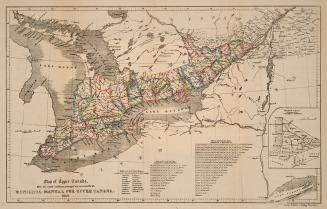
Plan of the town of Quebeck in Canada enlarged from Bellin's plan with additions [1757]
DateDecember 4, 1911
Names
Bellin, Jacques Nicolas, 1703-1772
(cartographer)
MacKellar, Pat
(contributor)
FormatMap
Notes| This map is a 1911 reproduction of the original 1757 Bellin map in Dominion Archives (now Library and Archives Canada). This true copy was created by James Aube on December 4th, 1911. |
Subject
Medium
Dimensions43.5 cm x 38 cm (17 1/8 in. x 14 15/16 in.)
ScaleBar scale; 400 feet to an inch
Language
ProvenanceJohn Ross Robertson Collection (JRR #54)
CollectionBaldwin Collection of Canadiana
Usage Rights
Public Domain
(Learn More)
Object Number912-71447-B25-SMALL
Rust, C. H. (Charles Henry), 1852-1927
1930 circa

Rae, W. Fraser (William Fraser), 1835-1905
1882
Cassell and Company, Limited


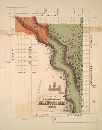
![With the exception of the lots on the Bay shore and those on Dundas or Lot Street coming under the head of sections A and C this plan is merely a proposed sketch of an intended addition to the town of York, His Excellency not having yet decided upon this internal arrangement [1833]](/internal/media/dispatcher/2109749/thumbnail)

Toronto Star (Firm)
3/8/1960