
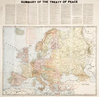
Rand McNally war map of the French front, strategic map of the battle ground in northern France
Date1917
Names
Rand McNally & Company
(publisher)
FormatMap
Subject
Medium
Dimensions1: 253 440 : 79 x 52 cm. and 55 x 79 cm.
Language
CollectionBaldwin Collection of Canadiana
Usage Rights
Public Domain
(Learn More)
Object Number940-43102-R12


C.S. Hammond & Company
1918
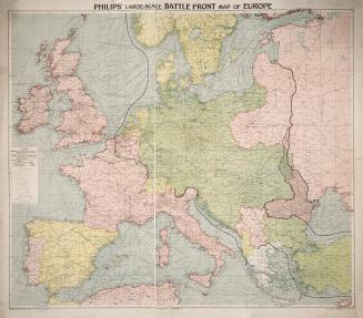

C.S. Hammond & Co.
1918 circa

