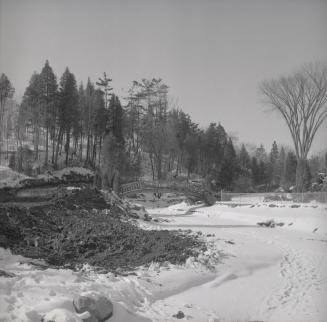
Edwards Gardens, Lawrence Ave. s. side, between Bridle Path & Leslie St.; looking n. up Wilket Creek towards Lawrence Ave. E., Toronto, Ontario
Date1958
Names
Salmon, James V. (James Victor)
(photographer)
FormatPicture
NotesEdwards Gardens, Lawrence Avenue south side, between Bridle Path & Leslie St.; looking north up Wilket Creek towards Lawrence Avenue East
Subject
Medium
DimensionsUnknown
Language
CollectionBaldwin Collection of Canadiana
Usage Rights
Public Domain
(Learn More)
Object NumberPICTURES-R-6323

Salmon, James V. (James Victor)
7/3/1955

Salmon, James V. (James Victor)
7/3/1955

Salmon, James V. (James Victor)
7/3/1955

Salmon, James V. (James Victor)
7/3/1955


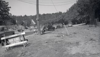
Leslie St., looking south between Eglinton & Lawrence Ave. E., during construction, Toronto, Ontario
Salmon, James V. (James Victor)
1958

Salmon, James V. (James Victor)
1952
Salmon, James V. (James Victor)
1952