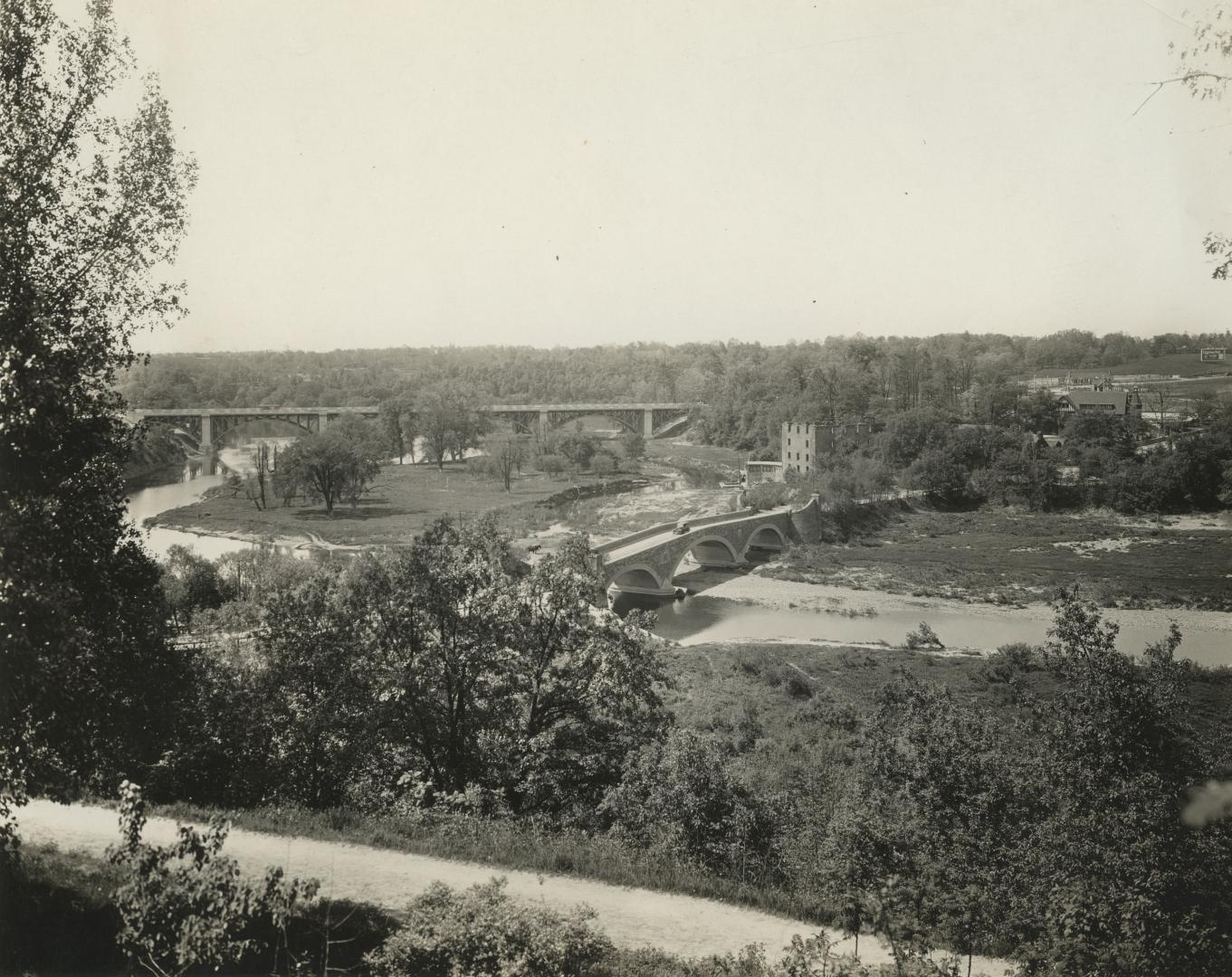

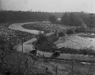
Old Mill Rd., looking west to bridge across Humber River between Catherine St. & Old Mill Rd., with Bloor St. bridge in background, taken from west end of Lessard Ave., showing Belt Line right-of-way in foreground, Toronto, Ontario
Date1925-09
Names
Gamble, William
(subject)
Pringle & Booth
(photographer)
FormatPicture
NotesOld Mill Rd., looking west to bridge across Humber River between Catherine St. and Old Mill Rd., with Bloor St. bridge in background; taken from west end. of Lessard Avenue, showing Belt Line right-of-way in foreground, Toronto, Ontario
Subject
Medium
Language
CollectionBaldwin Collection of Canadiana
Usage Rights
Public Domain
(Learn More)
Object Number980-9-494
Moore & Nixon-James
1929-03

Thompson, Stuart Logan, 1885-1961
5/4/1918

Salmon, James V. (James Victor)
1952
Williams, Charles A., active 1897-1962
1919?

Hammond, M. O. (Melvin Ormond), 1876-1934
1900 circa


Blakey, Joseph Adamson, 1870-1937
1905 circa