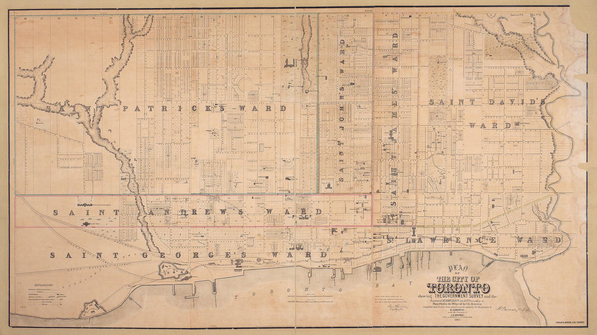

Plan of the city of Toronto showing the government survey and the registered subdivision into lots
Date1862
Names
Browne, H. J.
(cartographer)
Browne, John O. (Owensworth), 1808-1881
(contributor)
Fuller & Bencke
(lithographer)
J.O. and H.J. Browne (Toronto, Ont.)
(publisher)
FormatMap
NotesSubject
Dimensions98.5 cm x 175 cm (38 3/4 in. x 68 7/8 in.)
Scale1 inch = 5 chains
Language
CollectionBaldwin Collection of Canadiana
Usage Rights
Public Domain
(Learn More)
Object NumberT-1862-LARGE


![[Plate 30] Toronto Island Map: Atlas of the city of Toronto and vicinity from special survey founded on registered plans and showing all building and lot numbers.](/internal/media/dispatcher/1947573/thumbnail)

Denison, George T. (George Taylor), 1839-1925
1855
![[Plate 42] Atlas of the city of Toronto and vicinity from special survey founded on registered plans and showing all building and lot numbers.](/internal/media/dispatcher/1947551/thumbnail)
![[Plate 35] Atlas of the city of Toronto and vicinity from special survey founded on registered plans and showing all building and lot numbers.](/internal/media/dispatcher/2117712/thumbnail)
![[Plate 39] Atlas of the city of Toronto and vicinity from special survey founded on registered plans and showing all building and lot numbers.](/internal/media/dispatcher/1951307/thumbnail)
![[Plate 41] Atlas of the city of Toronto and vicinity from special survey founded on registered plans and showing all building and lot numbers.](/internal/media/dispatcher/2062984/thumbnail)
![[Plate 49] Atlas of the city of Toronto and vicinity from special survey founded on registered plans and showing all building and lot numbers.](/internal/media/dispatcher/2117710/thumbnail)
![[Plate 12] Atlas of the city of Toronto and vicinity from special survey founded on registered plans and showing all building and lot numbers.](/internal/media/dispatcher/1975819/thumbnail)
![[Plate 13] Atlas of the city of Toronto and vicinity from special survey founded on registered plans and showing all building and lot numbers.](/internal/media/dispatcher/1951285/thumbnail)
![[Plate 47] Atlas of the city of Toronto and vicinity from special survey founded on registered plans and showing all building and lot numbers.](/internal/media/dispatcher/2001237/thumbnail)