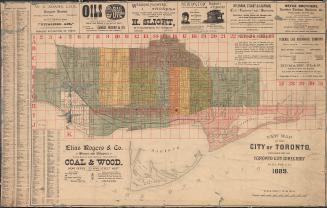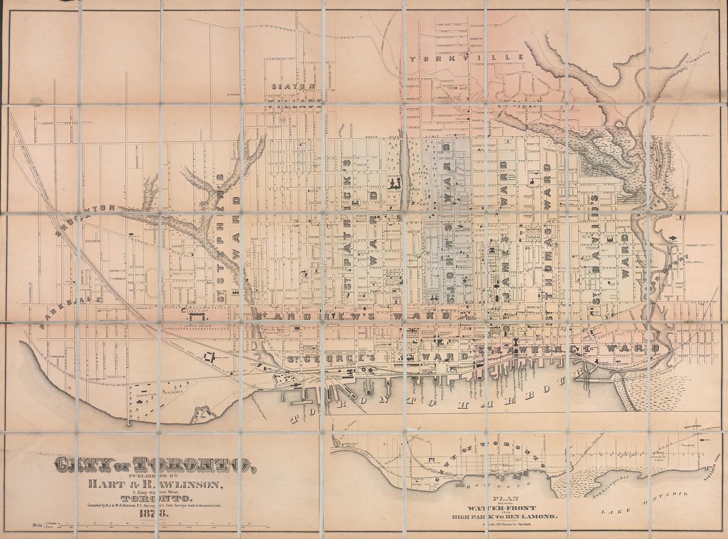

City of Toronto
Date1878
Names
FormatMap
NotesInsert: Plan shewing water-front from High Park to Ben-Lamond.
Subject
Dimensions69 cm x 93 cm (27 3/16 in. x 36 5/8 in.)
Scale1 inch = 40 chains
Language
CollectionBaldwin Collection of Canadiana
Usage Rights
Public Domain
(Learn More)
Object NumberT-1878-LARGE