

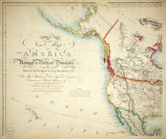
A new map of America exhibiting its natural & pollitical divisions compiled from discoveries and surveys of Sir Alexander Mackenzie, Don Juan de Langara, Vancouver, Elliott, Falconer &c.
Date1827
Names
Darton, William
(contributor)
Wilkinson, Robert
(cartographer)
FormatMap
NotesOriginally published by Wilkinson in 1824, and republished by William Darton, 58 Holborn Hill, London, 1827. Part 2 of 4 maps (4 parts make up the complete map when placed together)
Subject
Dimensions54 cm x 66.5 cm (21 1/4 in. x 26 3/16 in.)
Language
CollectionBaldwin Collection of Canadiana
Usage Rights
Public Domain
(Learn More)
Object Number912-7-W38-PT2-MEDIUM


Robert Sayer and John Bennett (Firm)
1775

Ballantyne, R. M. (Robert Michael), 1825-1894
1872
Ballantyne, R. M. (Robert Michael), 1825-1894
1885 circa
Ballantyne, R. M. (Robert Michael), 1825-1894
1872?

George E. Eyre and William Spottiswoode
1864

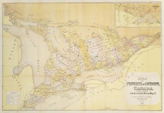
Bolton, Lewis O.L.S.
1888