Skip to main content
Advanced Search Objects: results
Close
Refine Results
Show Only Public Domain
Format
Map
(130)
Ephemera
(1)
Date
to
Names
Robertson, J. Ross (John Ross), 1841-1918
(14)
Unwin, Browne & Sankey
(10)
Unknown
(10)
Alexander & Cable Lithographing Co. Ltd
(9)
Copp Clark Company
(9)
Jefferys, Thomas, -1771
(6)
Bayfield, Henry Wolsey, 1795-1885
(5)
Browne, John Ownsworth, 1808-1881
(5)
Denison, George T. (George Taylor), 1839-1925
(5)
J & C Walker
(5)
Load all
Subject
Load all
Collection
Baldwin Collection of Canadiana
(131)
Language
Building, monument or park
Toronto Harbour
(10)
Fort York
(6)
Canadian National Exhibition (CNE)
(1)
Osgoode Hall (Toronto, Ontario)
(1)
Provincial Lunatic Asylum
(1)
Queen's Park (Toronto, Ont.)
(1)
Rosedale Ravine (Toronto, Ontario)
(1)
City, town or township
Toronto
(103)
Québec
(7)
Argenteuil
(1)
Detroit
(1)
Montréal
(1)
Walkerville (Windsor, Ont.)
(1)
Windsor
(1)
Windsor||Ojibway
(1)
Neighbourhood
Harbour
(20)
Garrison
(15)
Railway Lands
(14)
King-Spadina
(13)
Exhibition
(11)
St. Lawrence
(10)
Port Lands
(9)
Seaton Village
(9)
Toronto Islands
(9)
Financial District
(7)
Load all
North-south street
Yonge Street
(7)
Bathurst Street
(6)
Dovercourt Road
(5)
Dufferin Street
(5)
Christie Street
(3)
Sherbourne Street
(3)
Spadina Avenue
(3)
Keele Street
(2)
Leslie Street
(2)
Lippincott Street
(2)
Load all
East-west street
Bloor Street West
(17)
College Street
(6)
Davenport Road
(6)
Queen Street West
(5)
Dundas Street West
(4)
King Street West
(4)
Bloor Street East
(3)
Annette Street
(2)
Dundas Street East
(2)
Dupont Street
(2)
Load all
Sort:
Relevance
Date (Older First)
Date (Newer First)
Title (A–Z)
Title (Z–A)
Last Updated (Ascending)
Last Updated (Descending)
List
Images
Table
Previous
/ 7
Next
Advanced Search
Filters
Title
Names
Subject
Call Number / Accession Number
Date Range
to
Collection
All
Archives of Ontario
Arthur Conan Doyle Collection
Arts department
Baldwin Collection of Canadiana
Business, Science, and Technology department
Chinese Canadian Archive
City of Toronto Archives
Humanities and Social Sciences department
IBBY Collection for Young People with Disabilities
Languages and Literature department
Local History Collection, Annette branch
Local History Collection, Beaches branch
Local History Collection, Bloor/Gladstone branch
Local History Collection, Dufferin/St. Clair branch
Local History Collection, Gerrard/Ashdale branch
Local History Collection, Leaside branch
Local History Collection, North York Central Library branch
Local History Collection, Northern District branch
Local History Collection, Palmerston branch
Local History Collection, Parkdale branch
Local History Collection, Riverdale branch
Local History Collection, Sanderson branch
Local History Collection, Weston branch
Local History Collection, Wychwood branch
Merril Collection of Science Fiction, Speculation and Fantasy
Ontario History Quest
Osborne Collection of Early Children's Books
Special Collections in the Arts
Toronto Public Library Archives
Toronto Reference Library
Toronto Star Photograph Archive
Formats
All
Artifact (an object in our collections)
Book
Ephemera
Manuscript
Map
Photo Album
Picture
Language
All
Clear
131 for
Subject
:
http://nodes.emuseum.com/6QKN203O/apis/emuseum/network/v1/vocabularies/termMaster6716768
Plan of lots for sale in Dovercourt
1883
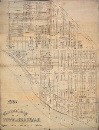
Edwards' map of the town of Parkdale compiled from plans of latest surveys
1887
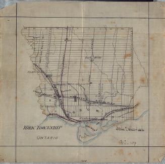
York Township, Ontario
1873
City of Toronto Ashbridge's Bay reclamation, plan of proposed subdivision shewing location of factory sites, wharf properties, and parks
1896
His Honor the Presdt approval of the town plot of York. 2nd addition
1798
Map of the Province of Upper Canada and the adjacent territories in North America
1825
Residential map of Rosedale Toronto's charming suburb
1905
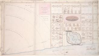
Plan of portion of property of G.T. Denison Esq.re situate in the city of Toronto
1853
Map showing precise levelling by the Geodetic Survey of Canada
1915
Plan of the city of Toronto showing the government survey and the registered subdivision into lots
1862
Map of the Border Cities of Windsor, Walkerville, Ford City, Sandwich and Ojibway Canada
1920
Plan of that portion of the marsh and water frontage, situate southward of lots no5 to 15 inclusive in the broken front con. in the township of York
1889
New map of the County of Perth Ontario compiled from original surveys and maps
1888
Plan of York Harbour
1815
Plan of the subdivision of parts of lots 36, 37, 38 and 39 containing about 240 acres formerly known as Carlton Park Race Course.
1883
Map of the counties of Terrebonne Two Mountains and Argenteuil
December 31 1861
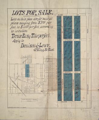
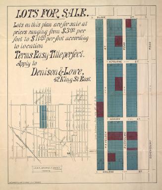
Lots for sale
1880
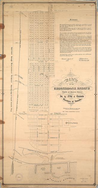
Plan of the Crookshank estate north of Queen Street in the City of Toronto, province of Canada
1853
Plan of the subdivision of part of lot no. 21, concession III from the bay, township of York. - Old Yonge St. - Deer Park
1885
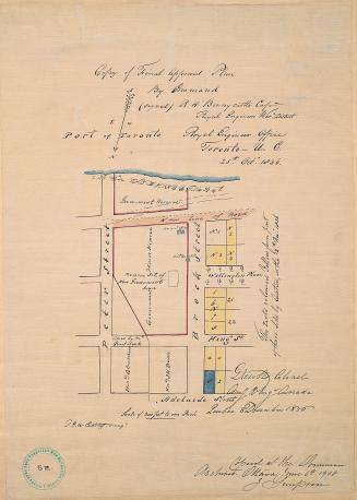
(1836) Copy of final approved plan, by Command
1908
Previous
/ 7
Next
RDF
XML
JSON